
search
Barcelona sants station map
Barcelona sants railway station map. Barcelona sants station map (Catalonia Spain) to print. Barcelona sants station map (Catalonia Spain) to download. Barcelona Sants Station was inaugurated in 1979 in the district of Sants-Montjuïc, quickly becoming the most important railway station in Barcelona and the second most important station in Spain (see barcelona sants station map). Each month the barcelona sants station receives more than 2,5 million passengers. The sants station offers short and long distance trips that run inside the country and internationally. From Sants you can travel to Paris, Madrid, Sevilla, Málaga, Lyon, Marsella and Toulouse. You can also use the station for medium distance travelling, going the main Catalonian cities, Aragón and Comunidad Valenciana.
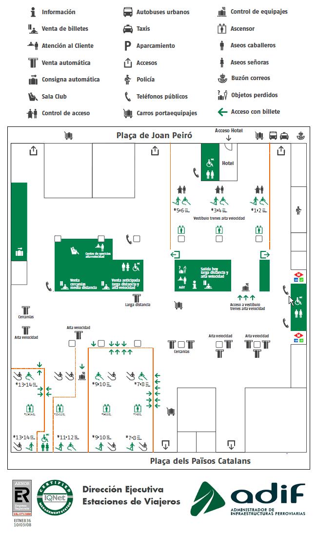
Sants Station is located at Plaça dels Països Catalans as its shown in barcelona sants station map. If you find yourself with some time, having to wait for your train to depart, you can visit the area surrounding the barcelona sants station, like the Palacio Balaña, an area with a taxi rank and a variety of cinemas or the close by promenade which has a variety of restaurants, cafés and bars.
The modern Barcelona Sants station only dates back to the 1970s, making it the newer of Barcelona two main train stations as its mentioned in barcelona sants station map. It was built in a modern airport style, with shops and offices at ground level and its platforms underground. Above ground level is a station hotel. This train station of sants is served by the flagship AVE high-speed train service between Barcelona and Madrid, with a journey time of 2h40mins.