
search
Barcelona bus lines map
Map of barcelona bus lines. Barcelona bus lines map (Catalonia Spain) to print. Barcelona bus lines map (Catalonia Spain) to download. Barcelona has a transport fleet of more than 1000 buses which operate on over 100 routes and connect all the city districts and the metropolitan area as its shown in barcelona bus lines map. The bus lines of Barcelona have low floors and are adapted for people with reduced mobility. Transport passes can be used on the metro, Barcelona tram, city-centre bus lines of the Ferrocarrils de la Generalitat (FGC) and Renfe trains (zone 1).
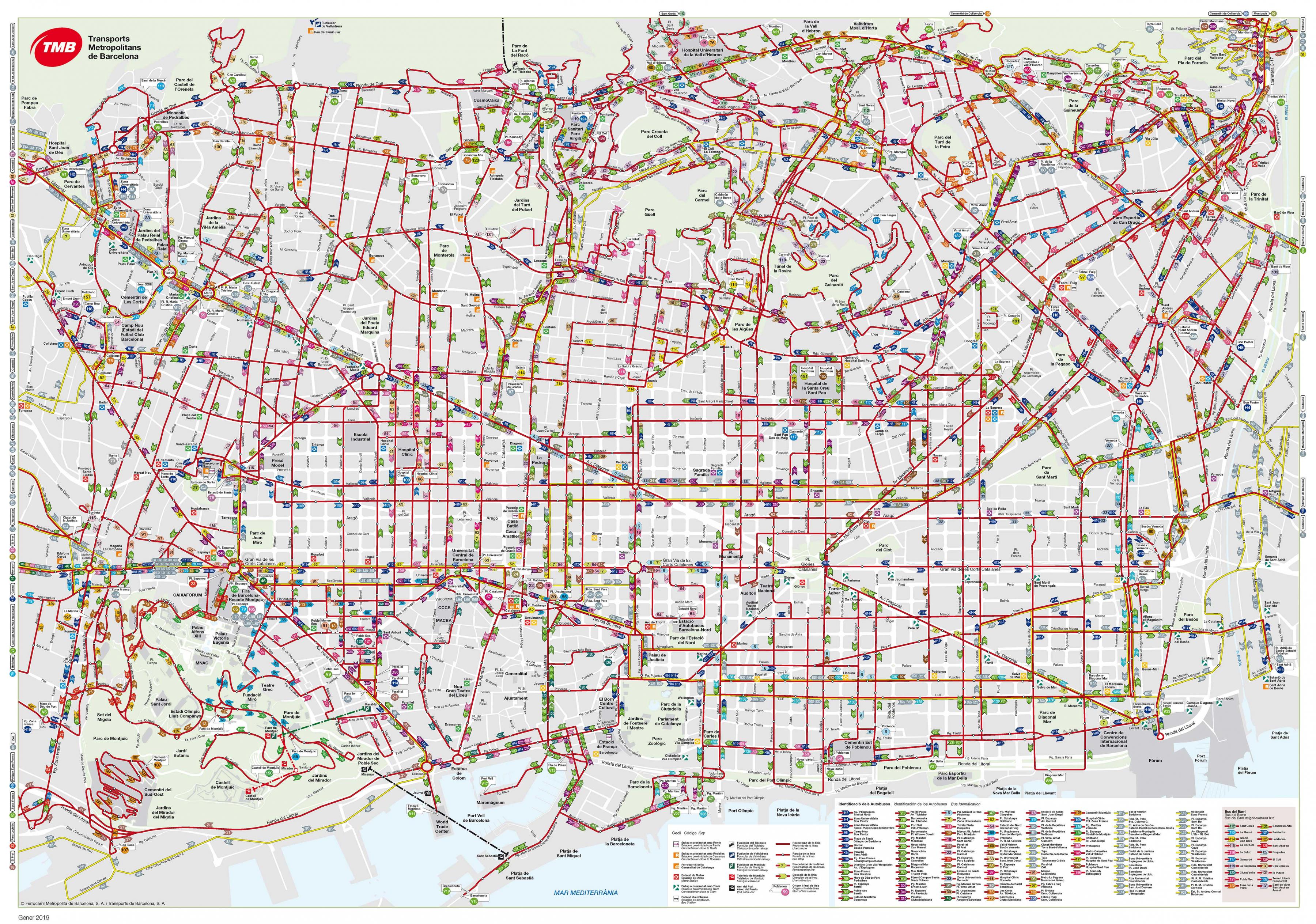
Newcomers to Barcelona might be put off using the bus lines because of the huge variety of routes available and the spaghetti-like route maps pinned up at bus stops (see barcelona bus lines map). However, taking the bus lines around Barcelona makes a lot of sense for several reasons: it gets you to those ‘hard to reach’ areas which are not accessible by metro; all buses are wheelchair-accessible; it is a cost-effective mode of transport and, perhaps best of all – you get to see Barcelona as you travel.