
search
Airport in barcelona spain map
Barcelona airport location map. Airport in barcelona spain map (Catalonia Spain) to print. Airport in barcelona spain map (Catalonia Spain) to download. Barcelona Airport (BCN), also known as El Prat Airport, is located along the coast only 12 kilometers southwest of the city of Spain. As you can see from the airport in barcelona spain map, Barcelona Airport is located just 12 km south of Barcelona City Centre between the towns of Viladecans, Sant Boi and El Prat de Llobregat, from which it take its name. Barcelona airport is also very close to the popular seaside resort of Castelldefels and the C-32 takes you first to Sitges and then down to the Costa Daurada resorts.
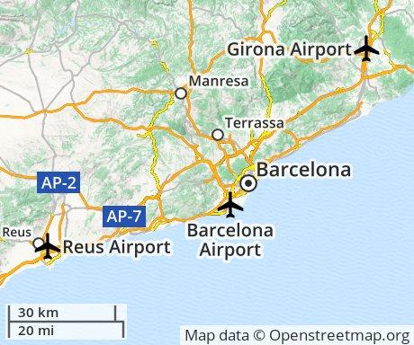
If you are planning to Hire a Car, by taking the Autovía del Nordeste to Sant Boi, you can easily reach the inland towns of Barcelona Province and Lleida Province. There is a RENFE train station at airport Terminal 2, which will take you to El Prat, where you can change for destinations south of Barcelona. You will have to continue to central Barcelona for destinations north including France, and desinations in the rest of Catalonia and Spain (see airport in barcelona spain map). Coach services to major Catalan and Spanish towns and cities are also available from Barcelona Airport.