
search
Barcelona tourist bus map
Tourist bus barcelona route map. Barcelona tourist bus map (Catalonia Spain) to print. Barcelona tourist bus map (Catalonia Spain) to download. The Barcelona tourist bus serves 44 stops and at least 87 attractions on 3 lines with a single ticket (as its mentioned in barcelona tourist bus map). The official tourist bus of Barcelona runs every 5 minutes and serves almost every corner of the city in an hour or two. More than 2,000,000 passengers a year board with a satisfaction rate of 95%.
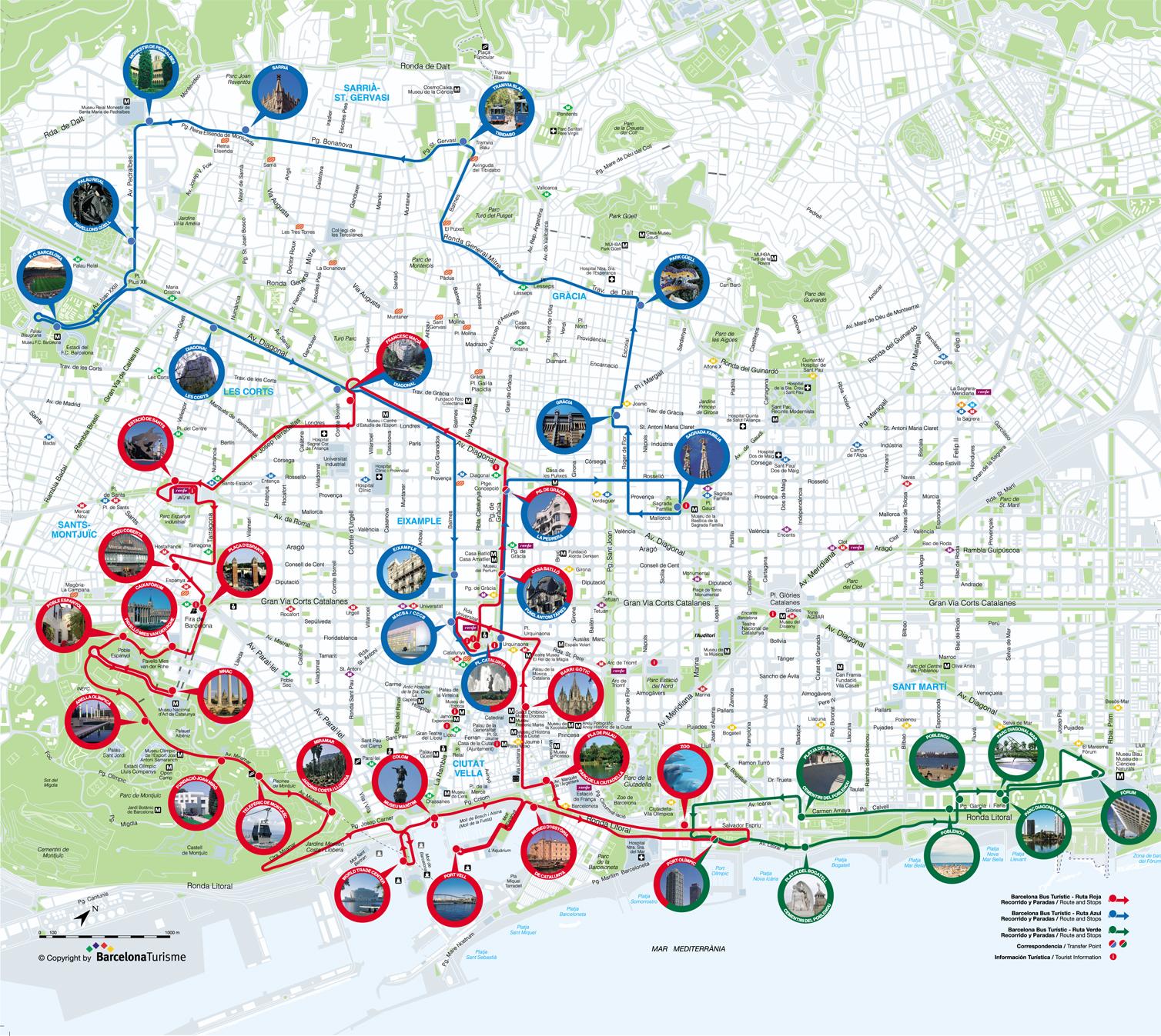
The Barcelona Tourist Bus offers the possibility of touring the city while making stops at important points of tourist interest. It has 3 different routes that can be taken using the same ticket (as its shown in barcelona tourist bus map). As is the case with tourist buses in other cities, the Barcelona bus has two floors with a panoramic view thanks to its open roof. It offers an audio guide in several languages and it is possible to get on and off as many times as you like.
There are three different routes that can be taken using the same ticket (see barcelona tourist bus map). The red route and the blue route bus take about two hours while the green route takes about 40 minutes. The red route bus makes stops at the following locations: Barcelona Sants train station, Creu Coberta, CaixaForum-Pavelló Mies van der Rohe, Plaza de España, Spanish Village, National Art Museum of Catalonia, Anella Olímpica, Joan Miró Foundation, Telefónica de Montjuïc, Miramar, Maritime Museum, World Trade Center, Port Vell, Museum of the History of Catalonia, Olympic Port, Bogatell Beach, Parc de la Ciutadella, Zoo, Pla de Palau, Gothic Quarter, Plaza de Catalunya, Antoni Tàpies Foundation, La Pedrera and La Diagonal.