
search
Map of barcelona city centre
Map of barcelona city centre streets. Map of barcelona city centre (Catalonia Spain) to print. Map of barcelona city centre (Catalonia Spain) to download. For the visitor, the main attraction still tends to be in barcelona city centre, particularly around the Ramblas (as its mentioned in the map of barcelona city centre). The famous promenade in barcelona city centre is separated from L’Eixample by the monumental Catalunya Square, and it leads down to the port and the Portal de la Pau Square, where the Christopher Columbus monument stands in commemoration of the discovery of America and the explorer announcement of it in Barcelona.
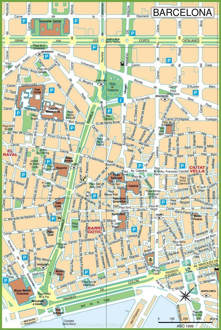
Barcelona City Centre is the area around the two main shopping streets that run off Plaça de Catalunya (see map of barcelona city centre): Portal de l'Àngel, which runs down towards, Barcelona Cathedral, Passeig de Gràcia, which takes you up the hill and into the District of Gràcia. Barcelona city centre extends as far as Plaça de la Universitat - to your left as you look up the hill - and Plaça Urquinaona - to your right.
If you are coming on holiday, Barcelona City Centre is where you are likely to spend most of your time and where you will probably look for accommodation. Many Barcelona hotel, hostel and apartment booking sites suggest that some establishments are closer to the barcelona City Centre than they actually are so the aim of this page is to come with a general definition of what Barcelona City Centre actually is (see map of barcelona city centre).