search
Rodalies barcelona map
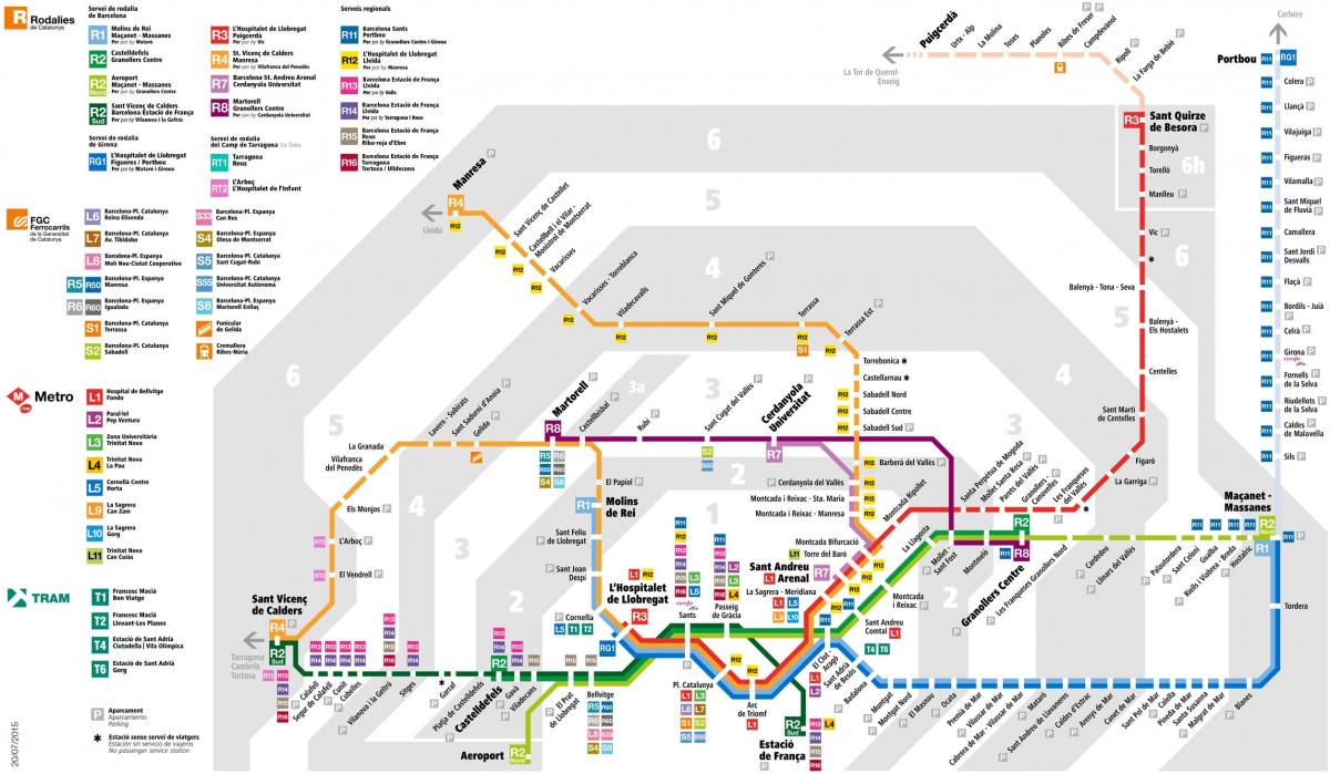
Rodalies map. Rodalies barcelona map (Catalonia Spain) to print. Rodalies barcelona map (Catalonia Spain) to download. The Barcelona Local Trains Network is run by the Spanish national railway company RENFE and is known as Rodalies. Until recently the Spanish word Cercanias was used for the Local Train Network in Barcelona, but now local train stations and lines are called Rodalies and are denoted with a large letter R. As you can see in rodalies barcelona map, there are 8 local train lines in Barcelona covering a variety of destinations within Catalonia, some of which are quite a distance away.
The Rodalies R3 Line runs from L'Hospitalet to Puigcerdà with many trains only going as far as Vic as its shown in rodalies barcelona map. The stops in Barcelona are Barcelona-Sants, Barcelona-Plaça Catalunya, Barcelona-Arc de Triomf, Barcelona-La Sagrera-Meridiana and Barcelona-Torre del Barò. This rodalies line connects Barcelona City Centre with the important inland town of Vic and then goes up towards the Ripoll and then Puicerdà, which are both entry points to the Catalan Pyrenees.
The rodalies R4 Line runs from Sant Vicenç de Calders in Tarragona Province to Manresa in Central Catalunya as you can see in rodalies barcelona map. The stops in Barcelona are Barcelona-Sants, Barcelona-Plaça Catalunya, Barcelona-Arc de Triomf, Barcelona-La Sagrera-Meridiana and Barcelona-Torre del Barò. This rodalies line takes you through important inland towns south of Barcelona and then turns further inland to Sabadell and Terrassa after passing through Barcelona centre.


