
search
Renfe train map barcelona
Barcelona train map renfe. Renfe train map barcelona (Catalonia Spain) to print. Renfe train map barcelona (Catalonia Spain) to download. Barcelona train Services are run by the National Company renfe and include local trains (as its shown in renfe train map barcelona)- Rodalies in Catalan, formerly Cercanías in Spanish, signalled by the letter 'R'. The regional or middle distance renfe train lines - Mitjana Distància, are signalled by 'MD' and long distance or Larga Distància services signalled by the letter 'LG'.
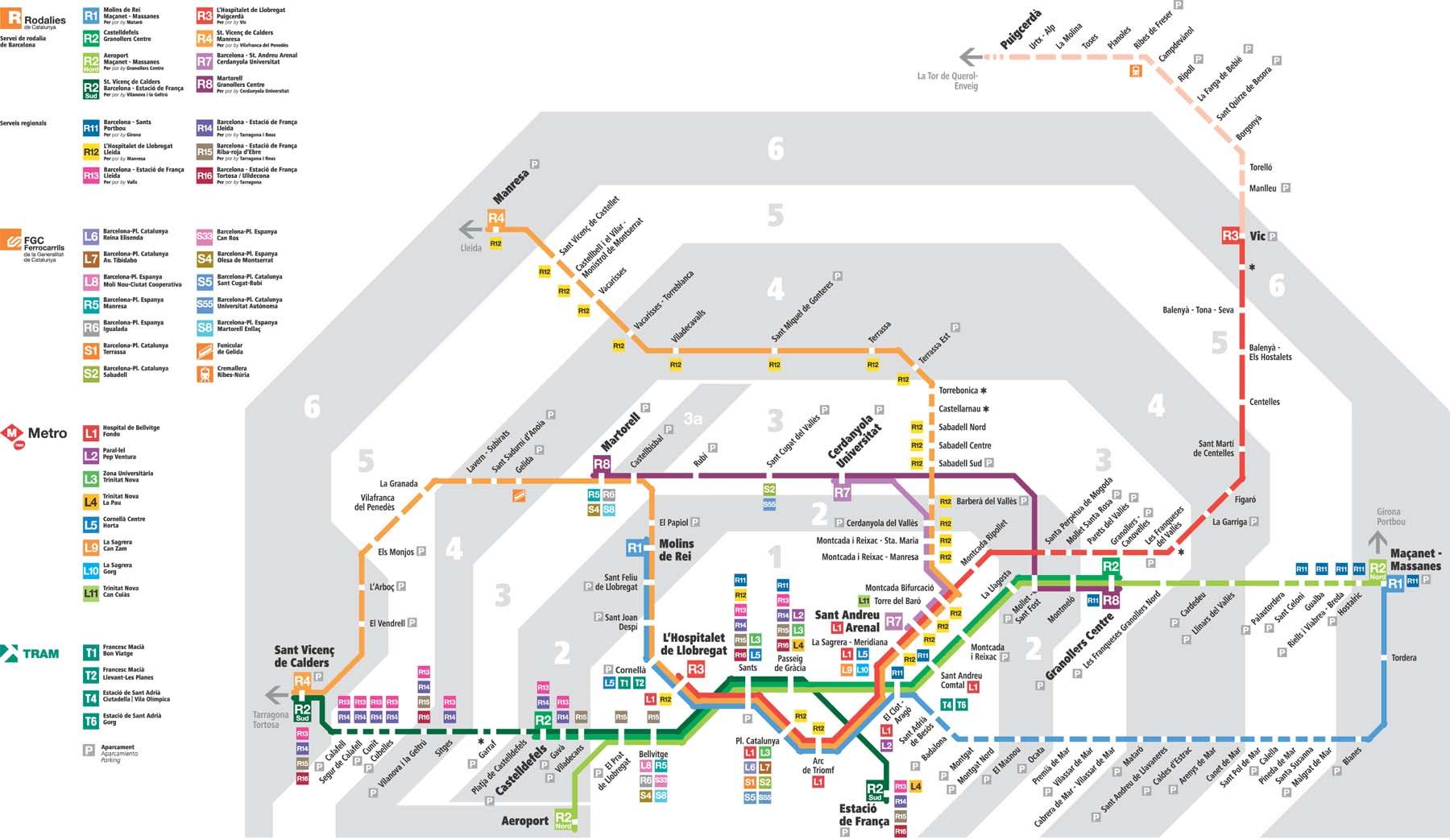
Renfe train Barcelona runs the High Speed AVE Service from Sants Estació to Madrid and other destinations (as its mentioned in renfe train map barcelona). There are currently 28 renfe train stations in Barcelona and 228 in the Barcelona Metropolitan Area. You need to use the Rodalies or Local Train Service is if you are travelling within Catalonia.
Barcelona is a major hub for renfe, the Spanish state renfe train network, and its main intercity train station is Barcelona-Sants station (see renfe train map barcelona). The AVE high-speed rail system designed for speeds of 310 km/h (194 mph), was extended from Madrid to Barcelona (Madrid–Barcelona high-speed rail line) in 2008. Generally, Barcelona has high-speed rail links with major cities of Spain.