
search
Barcelona tram map
Tram barcelona map. Barcelona tram map (Catalonia Spain) to print. Barcelona tram map (Catalonia Spain) to download. The Barcelona tram stopped operating in 1971. The only remaining line was the "Tramvia Blau", which still uses historic cars today and is operated for tourists (see barcelona tram map). The revival took place in 2004. The Barcelona tram was put back into service. Modern trains run on a new network that is still under construction.
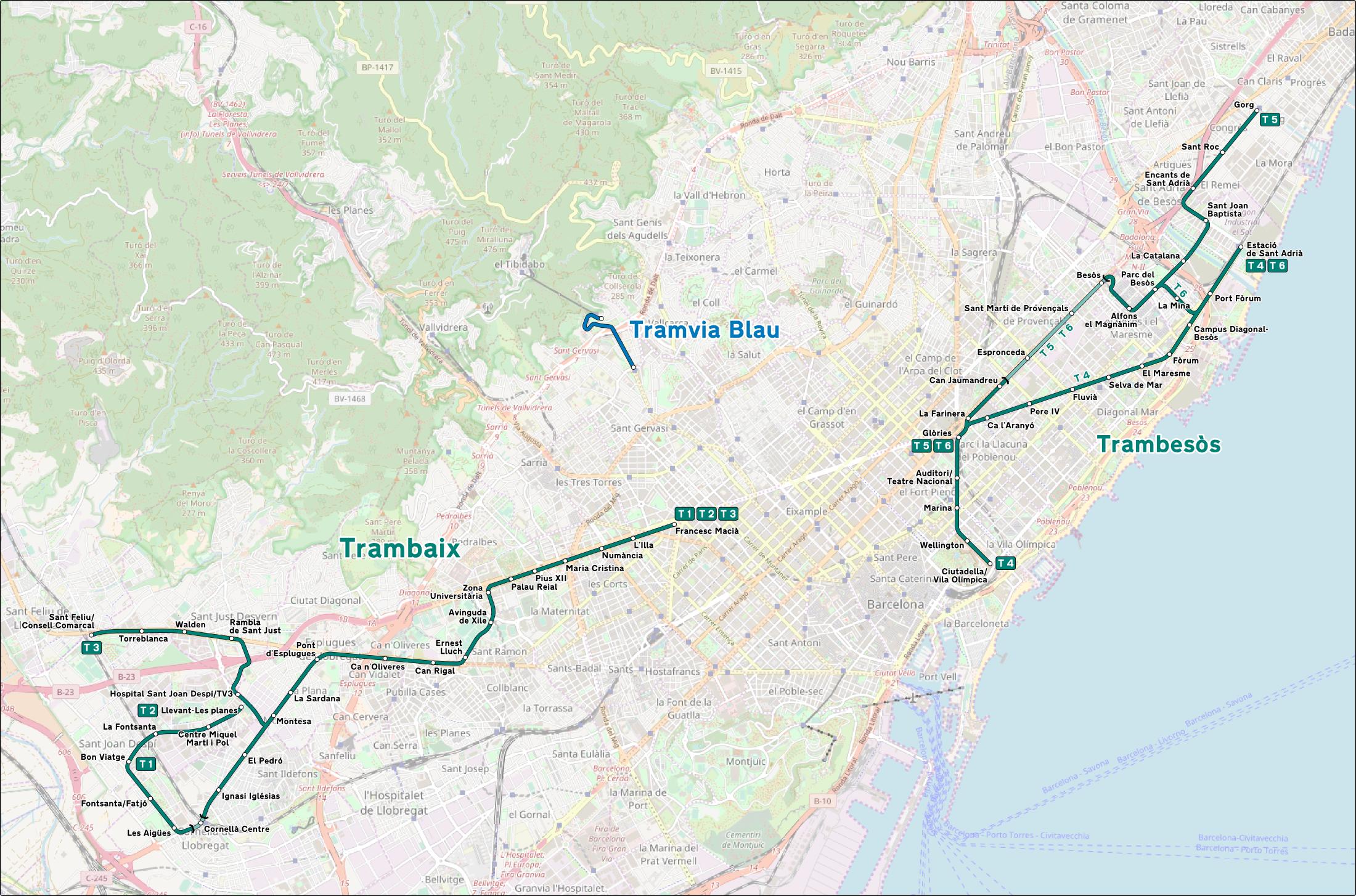
Barcelona tram network has six lines (as its shown in barcelona tram map): the first three trams are called Trambaix and the last three Trambesòs. Lines T4, T5 and T6 are the ones that cross the center of Barcelona. Trams run daily between 05:00 and 00:15. However, the schedules extend until 02:30 or 03:00 on Fridays and Saturdays for some lines (these schedules vary depending on the time of year).
A ride on the "Tramvia Blau" is not only an attraction for tram lovers (see barcelona tram map). The carriages are more than 100 years old and are the last survivors of the historic Barcelona streetcar closed in 1971. The approx. 1.2 km long line saves visitors a part of the climb to Mount Tibidabo (520 m). The Tibidabo offers you a beautiful view of the city and the surroundings of Barcelona. It is also known for its amusement park, the "Parque d'Atracccions".