
search
Barcelona topographic map
Map of barcelona topographic. Barcelona topographic map (Catalonia Spain) to print. Barcelona topographic map (Catalonia Spain) to download. Barcelona in barcelona topographic map, is facing the Mediterranean to the southeast. Barcelona is located on a plain generally confined by the Besós River (north), the Llobregat River (south), the rocky outcrop of Montjuich (567 feet [173 metres] high), and the semicircle of mountains of which Tibidabo (1,680 feet [512 metres]) is the highest topographic point in Barcelona.
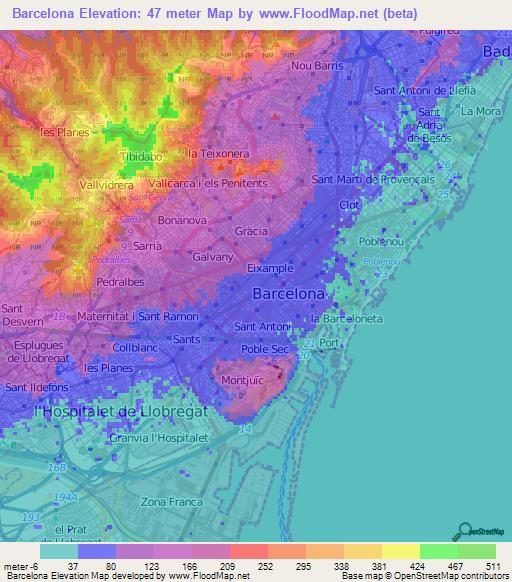
Barcelona as its shown in the barcelona topographic map is located on the northeast coast of the Iberian Peninsula. The topographic land area of Barcelona is 101.4 km2 (39 sq mi) with borders of Santa Coloma de Gramenet and Sant Adrià de Besòs to the north; the Mediterranean Sea to the east; El Prat de Llobregat and L'Hospitalet de Llobregat to the south; and Sant Feliu de Llobregat, Sant Just Desvern, Esplugues de Llobregat, Sant Cugat del Vallès, and Montcada i Reixac to the west.