
search
Barcelona metro station map
Barcelona metro line map. Barcelona metro station map (Catalonia Spain) to print. Barcelona metro station map (Catalonia Spain) to download. Barcelona metro station of espanya is located in Montjuïc, more exactly underneath Plaça d’Espanya, which is one of the most important squares in the city of Barcelona as its shown in barcelona metro station map. This Barcelona metro station serves as an interchange complex that connects several different railway routes from all over Spain. In addition, it is also connected to two of Barcelona metro lines, making it really simple to get from Montjuïc to anywhere you need to be.
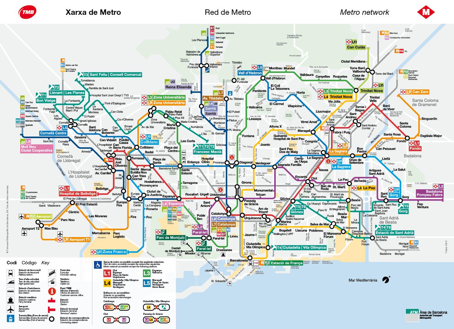
The metro of Barcelona is one of the most usually ways to move in the city, also to arrive to the city center. Barcelona has a wide underground system that allows you to move wherever you want throughout the city. There are a lot of metro stations in Barcelona city center as its shown in barcelona metro station map. You can see all them in this map. Some of more famous barcelona metro station are Plaça Catalunya, Universitat, Urquinaona, Liceu, Passeig de Gràcia.
Passeig de Gràcia metro station consists of only two platforms and its trains service only the region of Catalonia. This Barcelona metro station its close proximity to Las Ramblas and Plaza de Catalunya makes it very convenient for tourists, who normally concentrate in that area of Barcelona. Since it has a total of five different entrances, it might be a bit confusing at first. If you are heading for the trains and not the metro, barcelona metro station advisable that you use the entrance at the top of Passeig de Gràcia.