
search
Barcelona metro map with tourist attractions
Barcelona metro map tourist attractions. Barcelona metro map with tourist attractions (Catalonia Spain) to print. Barcelona metro map with tourist attractions (Catalonia Spain) to download. The red line of barcelona metro crosses the entire city attractions from east to west and stops at many tourist spots such as the Arc de Triomphe (Parco de la Ciutadella), Plaça Catalunya and Plaça d'Espanya (as its mentioned in barcelona metro map with tourist attractions). Barcelona metro main connections are with the yellow line in Urquinaona, the green line in Plaça d'Espanya, the purple line in Plaça Universitat or Clot and the blue line in Sagrera-Meridiana or Plaça de Sants.
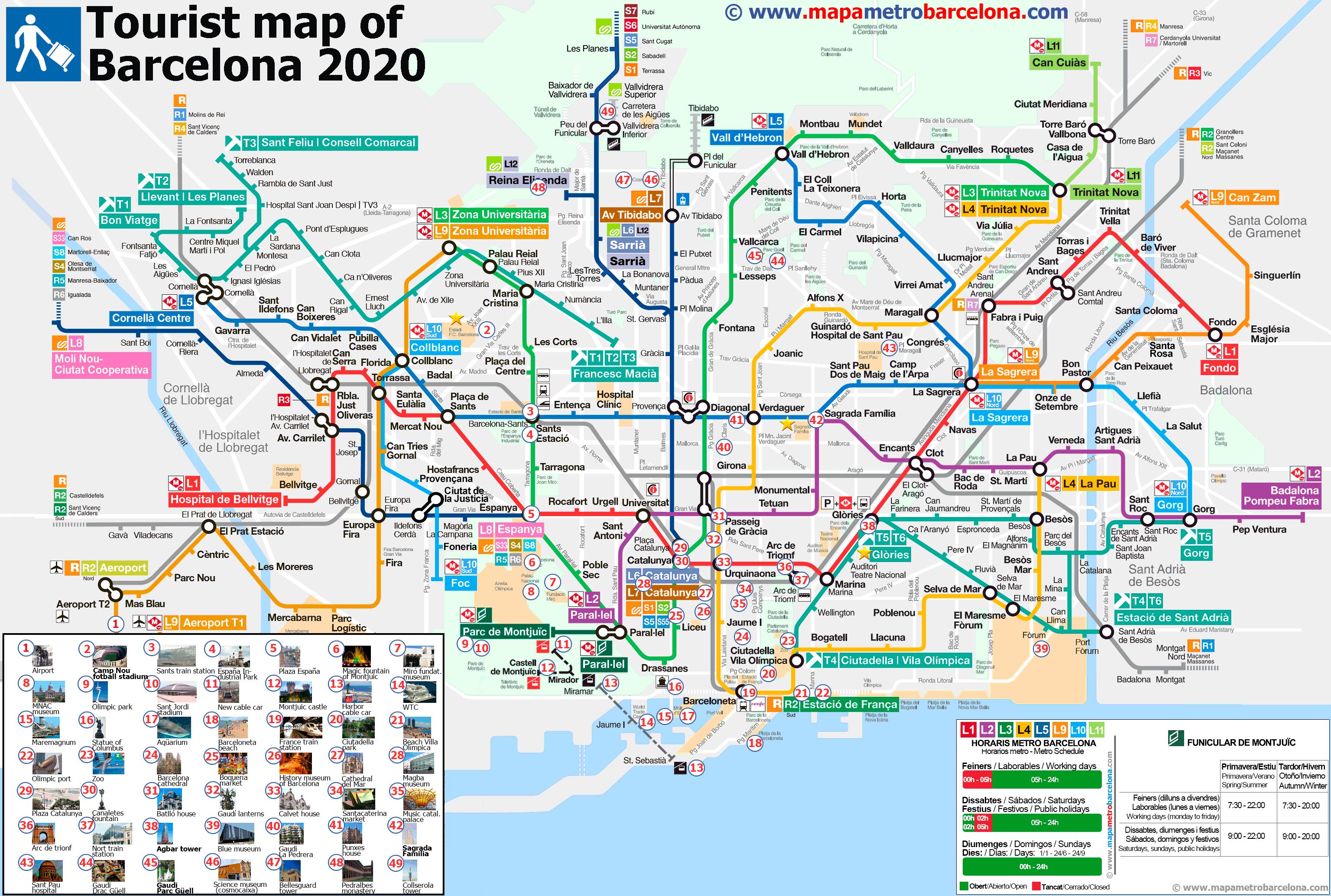
The purple line of barcelona metro map connects Badalona to Parallel. The main points of attractions of this line are the Sagrada Familia, Passeig de Gracia and Sant Antoni in the Raval (as its shown in barcelona metro map with tourist attractions). Barcelona metro main connections are with the yellow L4 line and the green L3 at Passeig de Gracia, the blue L5 at Sagrada Familia and the red L1 at Plaça Universitat or Clot.
Barcelona metro line has 3 stops on the Rambla (Plaça Catalunya, Liceu, Drassanes) and then continues north to Passeig de Gracia and Diagonal, while on the other side continues to Plaça d'Espanya through the Poble Sec and Parallel. This Barcelona metro also has stops near those attractions: Güell Park (Vallcarca), Camp Nou (Les Corts) and the Horta Labyrinth Park (Mundet). Barcelona metro main connections: with the blue L5 line at Diagonal, the red L1 at Plaça Catalunya and Plaça Espanya, the yellow L4 at Passeig de Gracia and the purple L2 at Parallel and Passeig de Gracia.