search
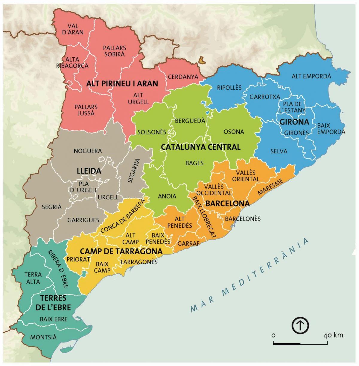
Catalunya barcelona map
Map of catalunya barcelona. Catalunya barcelona map (Catalonia Spain) to print. Catalunya barcelona map (Catalonia Spain) to download. Catalunya, is an autonomous community and historic region of Spain, encompassing the northeastern provincias (provinces) of Girona, Barcelona, Tarragona, and Lleida. The autonomous community of Catalunya occupies a triangular area in the northeastern corner of Spain. The capital and largest city in catalunya, Barcelona, is a major international cultural center and tourism destination (see catalunya barcelona map).
Catalunya is the foremost tourist destination of Spain, particularly the city of Barcelona, the beaches of the Costa Brava at Girona, and the Costa Daurada at Tarragona. In the Pyrenees there are several ski resorts. More than one-third of Catalunya population lives in Barcelona, the capital city (see catalunya barcelona map). Official languages are Catalan, Spanish, and Aranese.


