search
Eixample barcelona map
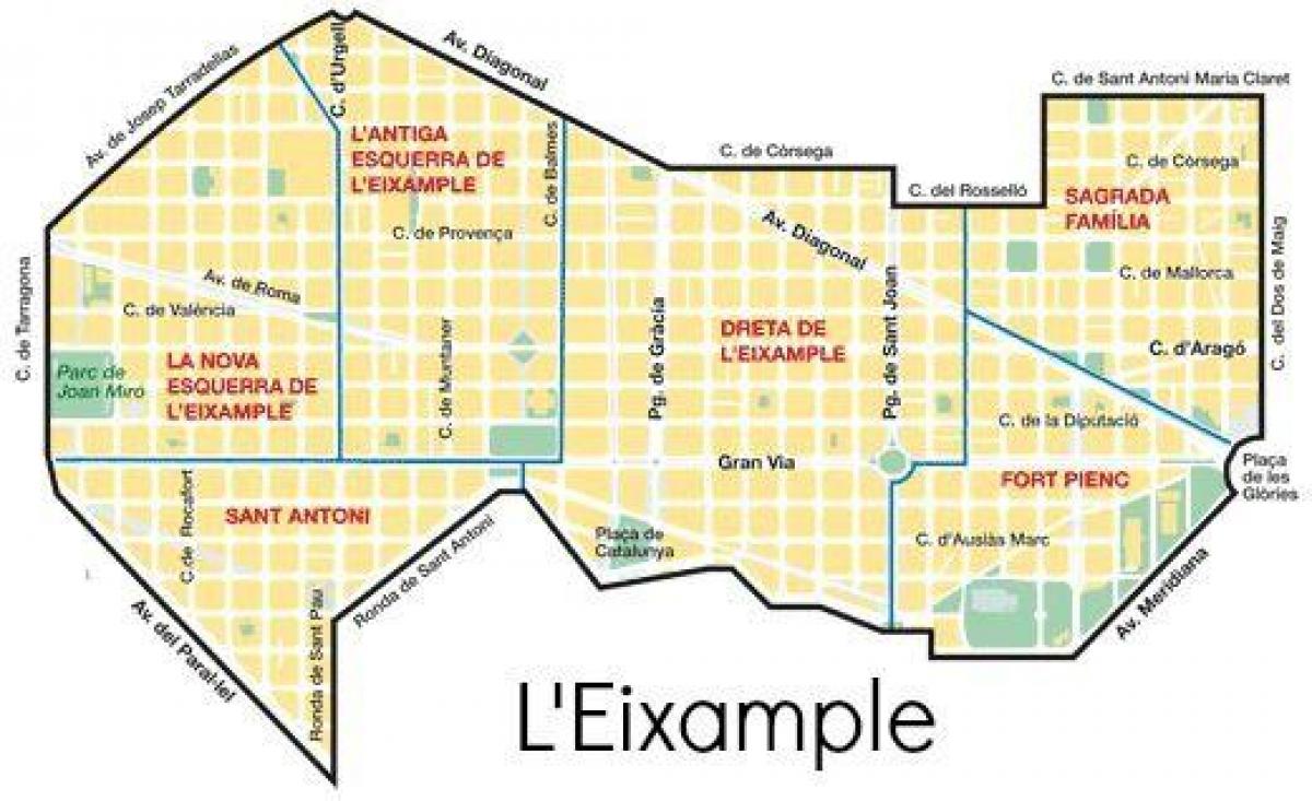
Map eixample barcelona. Eixample barcelona map (Catalonia Spain) to print. Eixample barcelona map (Catalonia Spain) to download. The Eixample (Catalan pronunciation: [əˈʃampɫə], Catalan for 'extension') is a district of Barcelona between the old city (Ciutat Vella) and what were once surrounding small towns (Sants, Gràcia, Sant Andreu etc. as its shown in eixample barcelona map), constructed in the 19th and early 20th centuries. Eixample population was 262,485 at the last census (2005). There are five administrative neighborhoods in eixample.
The Eixample is characterized by long straight streets (see eixample barcelona map), a strict grid pattern crossed by wide avenues, and square blocks with chamfered corners (named illes in Catalan, manzanas in Spanish). This was a visionary, pioneering design by Ildefons Cerdà, who considered traffic and transport along with sunlight and ventilation in coming up with his characteristic octagonal blocks, where the eixample streets broaden at every intersection making for greater visibility, better ventilation and (today) some short-stay parking space.
Eixample is often divided for practical purposes in two: Esquerra de l'Eixample and Dreta de l'Eixample (left and right sides of Eixample, respectively). Traditionally and officially eixample is divided into five neighbourhoods as its shown in eixample barcelona map. These are, in addition to the areas already mentioned, Sant Antoni, Sagrada Família and Fort Pienc, also known as Fort Pius. The latter has recently become notable for the number of Asian, chiefly Chinese residents and the proliferation of Asian shops.


