
search
Barcelona coast map
Map of barcelona coastline. Barcelona coast map (Catalonia Spain) to print. Barcelona coast map (Catalonia Spain) to download. Within easy reach of Barcelona by train or car, the comarca of El Maresme and its coastline includes some of the best beach resorts north of Barcelona as its shown in barcelona coast map. Calella is the best known of these but the Maresme has some delightful spots both on the coast and inland. The capital of the Maresme is the industrial town of Mataró but the comarca real attraction lies in its beach resorts. The coast south of Mataró, which includes Montgat, El Masnou, Premià, Vilassar and Cabrera is nice enough, but the northern section is a much better holiday destination.
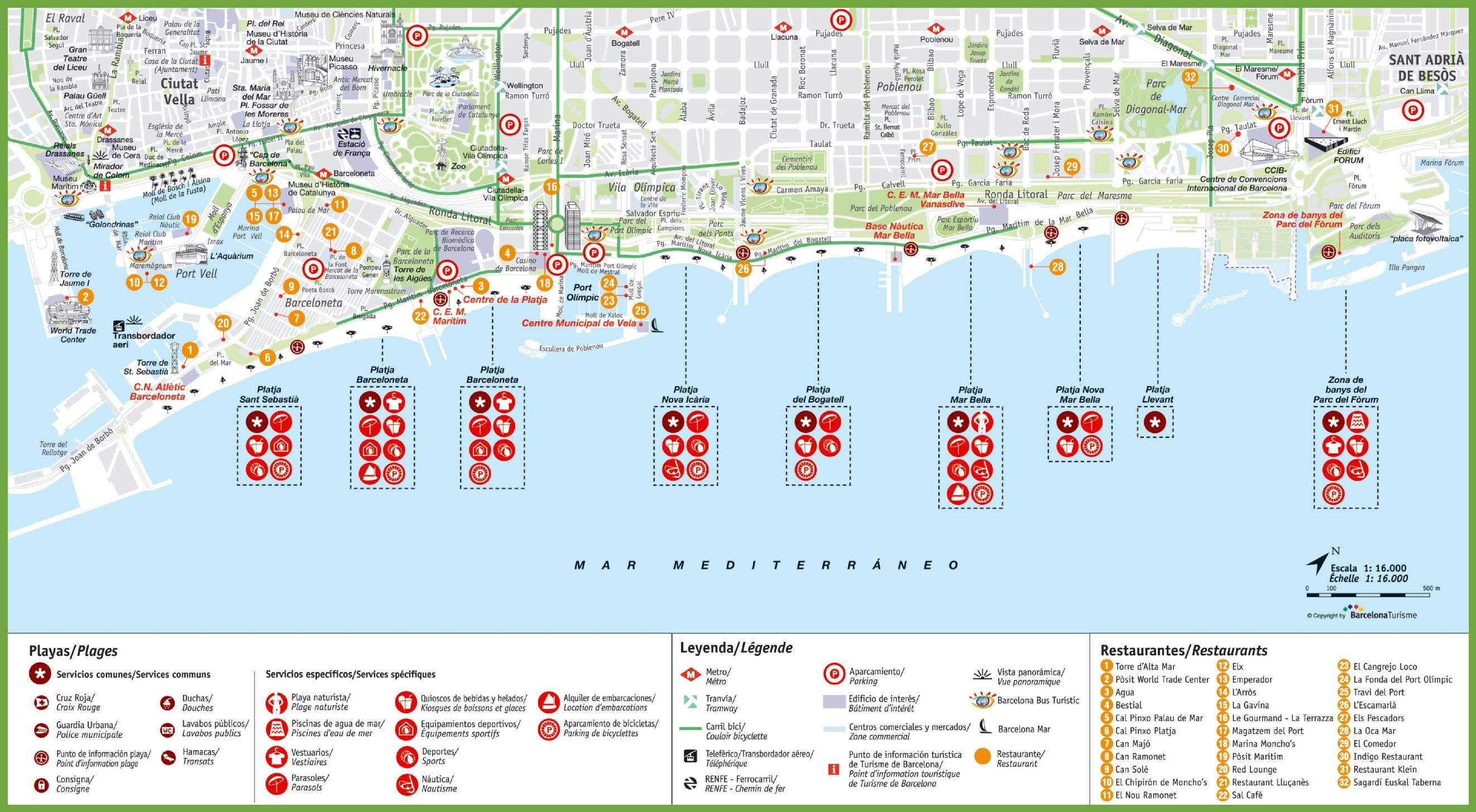
Located to the south of Barcelona and with easy reach of Barcelona El Prat Airport, the comarca of El Garraf comprises six municipalities as its mentioned in barcelona coast map. Cubelles, Vilanova i La Geltrú, Sant Pere de Ribes and Sitges all have at least some coast and Canyelles and Olivella are situated in the mountainous interior. The Garraf is an extremely attractive part of Catalonia and definitely the best stretch of the coast within easy reach of Barcelona.
The coast, which stretches from about 40 kilometres north of Barcelona and to the French border, is called Costa Brava, or the brave coast as you can see in barcelona coast map. The most important city in this area is Girona with slightly less than 100.000 inhabitants, which also has an international school (St. George College). The coast is quite similar to the French Riviera with mountains that stretches all the way to the ocean creating nice lagunes with intimate and romantic sandy beaches.