
search
Barcelona airport terminal map
Barcelona airport map terminal 1 and 2. Barcelona airport terminal map (Catalonia Spain) to print. Barcelona airport terminal map (Catalonia Spain) to download. Although the two Barcelona airport terminals are 4 kilometers apart, getting between them for connecting flights is easy (as its shown in barcelona airport terminal map). There is a free shuttle bus that runs between the two terminals about every 6 to 8 minutes, 24 hours a day, and traveling between the terminals takes about 15 minutes maximum. Connections to and from the city center of Barcelona are also available at both airport terminals.
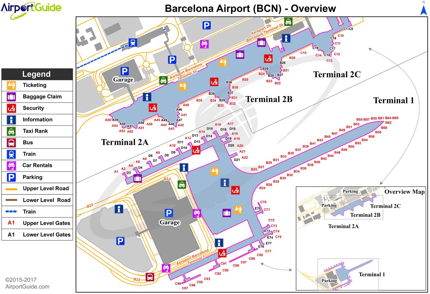
Back in 2009, the Barcelona Airport, also known as the Barcelona-El Prat Airport, expanded from one terminal to two in order to accommodate heavy traffic due to the growth of the city and keep things moving efficiently (as its shown in barcelona airport terminal map). Terminal 1 was built 4 kilometers away from the first terminal and the old terminal became Terminal 2. Today, Terminal 1 operates the majority of the flights while the two terminals together have made flying in and out of Barcelona much easier. Here is everything you need to know about Terminals 1 and 2 at the Barcelona airport.
As a result of the heavy growth, the Barcelona airport was expanded in 2009 in order to provide better service to more passengers. A new terminal (Terminal 1) was built 4 km away from the terminal 2 (as its mentioned in barcelona airport terminal map). The new Terminal 1 of Barcelona airport now operates 70% of flights. The old terminals A, B and C, are now Terminal 2, which operates a few flights.